A. List of Illustrations
B. Select Bibliography
C. Blog Disclaimer
A. List of Illustrations (with sources where applicable)
Fig. 1. Title Page
to History of Devonshire included
in Part No. 1.
1. Introduction
Fig. 2.
The covers of No. 1. of each quarto parts
series: Jennings and Fisher.
2. Steel Engraving
Fig. 3. Scene of the
entrance to the River Dart in History of
Devonshire.
Fig. 4. W Dawson’s
view of Aqueduct over the Torridge in
History of Devonshire.
Fig. 5. Four woodcut
capital initial letters in History of
Devonshire.
Fig. 6.* Sidmouth:
lithograph published by J Wallis & H Haseler, c.1822.
Courtesy of Mike Jones at Rare
Old Prints: http://www.rareoldprints.com/.
3. Subscribers and Funding
Fig. 7.
Dedication to John Baring and Matthew Lee on Donn´s map of Devon.
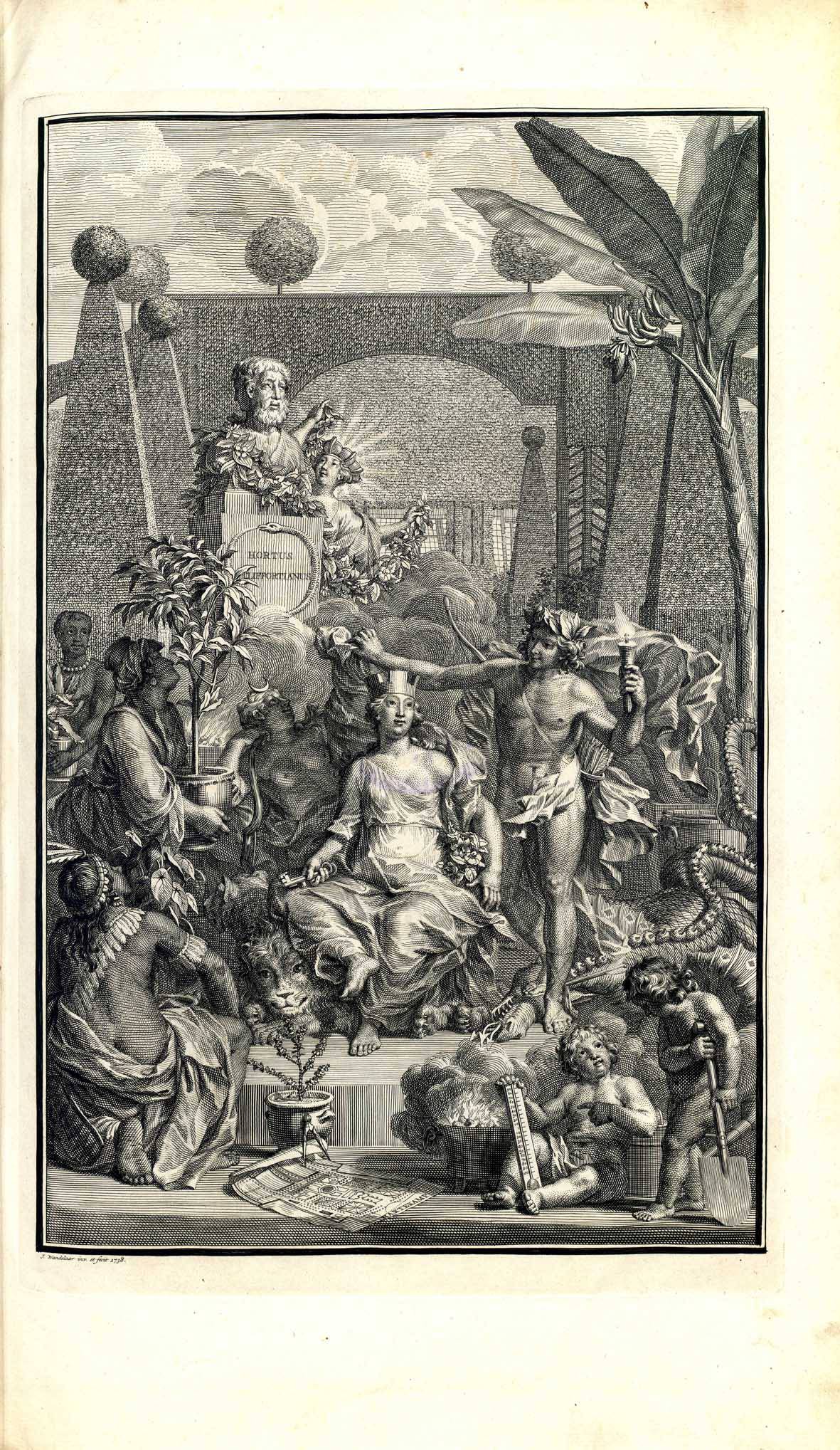
Fig. 8*. Frontispiece
to Linnaeus's Hortus Cliffortianus.
Public domain, via Wikimedia Commons
- /2/23/Linnaeus_Hortus_Cliffortianus_frontispiece.
All rights reserved.
Fig. 10. Watermouth dedicated to Davie Bassett Esq., by Jennings.
Fig. 11. Lary
Bridge dedicated to Earl of Morley by Fisher.
Fig. 12. Town-Hall, Column & Library of Devonport in Devon Illustrated.
Fig. 13. Truro in Cornwall Illustrated.
Fig. 14. Nutwell Court after rebuilding in 1799 was
rejected. Courtesy of Wikimedia Commons and “Lobsterthermidor”.
4. The Authors
Fig. 15. Back cover of a Fisher part with advert for Drawing-room Scrap Book.
Fig. 16. John Britton
contributed to all eight works on this advertising page.
Fig. 17*.
The Unitarian Church in Kingswood, Birmingham. The photograph was found on
their website. https://www.ukunitarians.org.uk/kingswood/.
5.
The Printers and Publishers
Fig. 18*. The Borghese
Palace from The Landscape Annual of
1831.
Extracted from Thomas Roscoe’s The
Tourist in Italy (1831) pub. Jennings and Chaplin. Image taken from William
Miller, Public domain, via Wikimedia Commons.
Fig. 19. Ireland Illustrated and Lancashire Illustrated advertised in
Fisher No. 3.
Fig. 20. Moore No. 1 with Address to the reader (octavo left) and Moore No. 22 advertising Moule´s English Counties Delineated (quarto right).
6.
The Engravers
Fig. 21. Entrance to
Bristol by W Bartlett & C Mottram for Jones & Co.
7.
The Maps and Mapmakers
Fig.
22*. Schmollinger’s map of Devonshire
for Moore with vignettes. The image of the map of Devonshire was kindly
provided by David Smith of Modbury at www.antique-maps-online.co.uk.
Fig.
23. Schmollinger’s map of Exeter
for Moore drawn by R Brown.
Fig.
24. J&C Walker’s map of Devonshire
for Fisher with vignette by Allom and Floyd.
Fig.
25. Map of Cornwall for Fisher
signed by B R Davies.
Fig.
26. Map of Devonshire by John
Dower for Moule with view of Exeter Cathedral.
8.
Publication History
Fig. 29. Moore covers from No. 22 were numbered by hand.
Fig. 30. Standard Fisher cover: Part 33 included the map of Cornwall.
Fig. 31. Alternative Fisher cover: Part 15.
9. Collaboration
or Coincidence
Fig. 33. Title Page
to Devonshire & Cornwall
Illustrated 1840.
Other
Illustrations.
Fig. 34. N W View of
Exeter Cathedral for Jennings with George Virtue imprint, dated 1833.
Fig. 35.
Torridge Canal became Rolle Canal in later editions.
Fig. 36. Fisher Frontispiece dated 1840 (above) and York Hotel etc. 1845 (below).
* Images marked with an asterisk were kindly provided by the persons and institutions named or are freely available on-line for research and non-commercial, academic purposes. All other images are from works that are or were in the author’s private collection unless specifically stated.
B. Select Bibliography.
Batten & Bennett (1); The Printed Maps of Devon; Devon Books; (1996/2008 see website for updated version).
Bennett & Batten; The Printed Maps of Exeter; Little Silver; 2010.
Campbell, Tony; The Original Monthly Numbers of Moule’s ‘English Counties’; in The Map Collector; Issue 31; June 1985.
Clapp, S L C; ‘The subscription enterprises of John Ogilby and Richard Blome’ in Modern Philology, 30 (1932–3).
Davidson, James; Bibliotheca Devoniensis; William Roberts; 1852.
Jenkins, Alexander; The History and Description of the City of Exeter and its Environs; 1806.
Jesusa Vega; Lithography and Spain: the difficult beginnings of a new art; in JoPHS; 1998.
Mackenzie, Ian; British Prints; Antique Collectors Club; 1987.
M‘Kenzie-Hall, James; Illustrated Travel: steel engravings and their use in early nineteenth-century topographical books with special reference to Henry Fisher & Co, unpublished PhD, Southampton-Solent University (2011).
Maxted, Ian; Exeter Working papers (updated 2020); for example, bookhistory.blogspot.com/2014/10/devon-imprints-exeter-featherstone.
Maxted, Ian; https://devon-bibliography.blogspot.com/ (updated 2022).
Maxted, Ian; https://etched-on-devons-memory.blogspot.com/ (updated 2018).
Moseley, Brian; website at www.oldplymouth.uk/Laira%20Bridge.
Schuchard, Margret; John Ogilby – Lebensbild eines Gentleman; Paul Hartung; Heidelberg; 1973.
Somers Cocks (1977); Devon Topographical Prints, 1660-1870 – A Catalogue and Guide; Devon Library Services; Exeter; 1977.
Todd, William B; A Directory of Printers and Others in Allied Trades; P H S; 1972.
Twyman, Michael (1); A Directory of London Lithographic Printers; P H S; 1976.
Twyman, Michael (2); The British Library Guide to Printing; British Library; 1998.
Van Eerde, Katherine S; John Ogilby and the taste of his times; Dawson; Folkestone; 1976.
Worms, Laurence; Some British Mapmakers in Ash Rare Books Catalogue and Price List; 1992.
Worms, Laurence & Baynton-Williams, Ashley; British Map Engravers; Rare Book Society; 2011.
I have mentioned three sources above, and I do
not apologise for mentioning them again. Ian Maxted has worked tirelessly to
compile all manner of material regarding Devon´s past and all has been posted
on the internet, mainly through his blog. His main addresses are:
Exeter Working papers (updated
2020); bookhistory.blogspot.com/
Devon Bibliography of
engravers, printers, publishers etc involved in the publishing trades: https://devon-bibliography.blogspot.com/
(updated 2022).
Etched on Devon´s Memory
mainly concerning prints: https://etched-on-devons-memory.blogspot.com/
(updated 2018).
James M‘Kenzie-Hall has posted his very informative
work on-line as a .pdf; Illustrated
Travel: the topographical steel-engraved books of Henry Fisher, Son & Co
(c.1829-1844).
https://pure.solent.ac.uk/ws/portalfiles/portal/31193894/MKenzie_Hall.pdf
Wikipedia and the allied sites (Wikiwand etc.)
are acquiring more and more up-to-date information.
My own work, much produced in collaboration
with Frances Bennett, is freely available (and occasionally brought up to
date!) including:
Batten & Bennett (1); The Printed Maps of Devon; Devon Books;
(1996/2008 see website for updated version).
Batten & Bennett (2); The Victorian Maps of Devon; Little
Silver; (2000/2010 see website for updated version).
Bennett & Batten; The Printed Maps of Exeter; Little
Silver; 2010; (see website for updated version).
Batten; The Tourist Maps of Devon; Little Silver; 2011; (see website for
updated version).
In addition, my blog is full of articles on subjects of Devon interest, such as The Hearders of Torquay, Edward Cockrem and the Durnford Sisters or John Cooke, Engraver and Publisher. A good place to start is my Welcome page: https://welcome-to-kits-blog.blogspot.com/
C. Blog Disclaimer
My contribution to small print! This is a personal blog and I am responsible for both content and any mistakes. Corrections welcome!
All content provided on this blog is for informational purposes only. The owner of this blog makes no representations as to the accuracy or completeness of any information on this site or found by following any link on this site. The owner will not be liable in any legal interpretation for any errors or omissions in this information nor for the availability of this information. The owner will not be liable for any losses, injuries, or damages from the display or use of this information. If you choose to quote my work I will be, of course, be flattered: however, I will expect you to quote your source and observe the usual blog protocol.Illustrations
Unless stated, all images are from my own collection. Most are from maps and books that are, or were, in my collection. I am perfectly happy for you to use the images on a non-profit-making basis in your own work. Again: observe web protocol and quote your source. Where I have indicated that the image is from an outside source, this means I have contacted that institution or person and these images are copyright with all rights reserved. Reproducing these images may well infringe copyright regulations. The user is responsible for complying with copyright rules. Please check the List of Illustrations above.
Downloadable Files
Any downloadable file, including but not limited to text and image such as pdf, doc, jpeg, png, is provided at the user’s own risk. The owner will not be liable for any losses, injuries, or damages resulting from a corrupted or damaged file.
Comments
Comments are welcome. However, I reserve the right to edit or delete any comments submitted to this blog without notice where I deem it to be spam or questionable spam, contains language or concepts that could be deemed offensive, and of course where comments contain hate speech or similar.
The blog owner is not responsible for the content in comments.
This policy is subject to change at anytime.


